But today (as with so many other days) Wash Lane remains unvisited by the I of these words. A morning run led close by but little thought was paid to the Lane. Until now (a now that will stretch elastically across days to find pockets of writing opportunity). A form of attending arises and the ‘desktop’ becomes the locus of activity; something of Wash Lane becomes apparent a kilometre northwards of its gravelly course. The unremarkable Wash Lane has (unwittingly) left traces other than (or rather, in addition to) the slowly altering stuttering series of gently rising curves.
Of course, the cartographers have been (t)here. Certain aspects of the Lane are given a form of permanence through theodolite, measure, pen and paper—an endeavour not without sweat and physical exertion for the ‘plotters’—and more latterly, the assistance of satellites, seemingly so remote from the gravel and oaks, projects the Lane’s course into digital space.
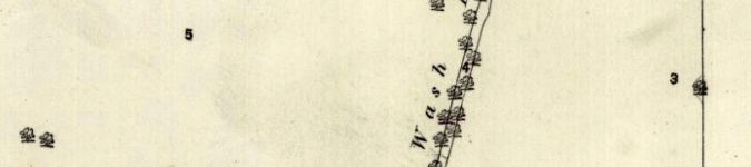
Initially the cartographic renderings are easy to keep count of: two 25-inch and three 6-inch maps courtesy of the Ordnance Survey through the late-1800s and into the mid-twentieth century. Two 1-inch maps from 1899—on one version, the cartographer’s hachures exaggerate the prominence of the fold of land that Wash Lane sits within. The outline edition quietly accepts the Lane’s line. The 1940s bring colour, although none to Wash Lane. The dotted line of the parish boundary running along Dove Lane is familiar to most of these chart-views. Over time the renderings multiply and updates and alterations begin to occur at ever shorter intervals augmented by the aerial photography of the last sixty years (a process which itself has increased in frequency).
Prior to the modern mapping came the Tithe map of the 1840s. Wash Lane runs unlabelled here but is clearly found as the lines of lanes and roads has changed little in the intervening years. What has changed are the enclosures that accompany the Lane. Today’s one field to the west of the Lane was five enclosures (Nos. 66 to 70) two of which had their eastern limit set by Wash Lane at the time of the Tithe. On the east side five enclosures had their western boundaries defined by the Lane (Nos. 59 and 62 to 65). Wash Lane itself is numbered ‘204’ and its then ownership will one day reveal itself to a writing I. This ownership is a trivial point perhaps but all part of the Lane’s story; a story that is impossible to give any value to especially on the part of the Lane itself. If the Lane can be described as a self.
The manner of writing (above) has given the Lane an agency that it does not possess in a traditional way; its identity is born from a usage reinforced by a subsequent naming. The Lane must be seen elsewise, perhaps as a multiplicity that has the (mis)fortune to have risen to enough prominence to be awarded a nominal presence. And yet, in its usage it collaborates with users and inhabitants as the geology, morphology and ecology impact how the Lane is encountered and followed; whilst, reciprocally, the Lane is altered through use. It could also be suggested that it grows recursively as the fractal narratives multiply, interweave and die back.
It can easily be imagined that Wash Lane, its course, was born from necessity—a need to move from what is today the metalled road down to Dove Lane (or vice versa). Maybe the strip enclosures to the north of Dove Lane needed better access from the direction of the hamlet or the farm. The Tithe map sets a latest possible date for the Lane but there maybe exists an estate map or manuscript that more clearly sets out the line, purpose and ownership of this brief course.
This further introductory writing arguably does not go anywhere, much like the Lane ‘itself’ but, like the cartographer and the surveyor, the writing I is laying out marks to triangulate from to get to know the meaningless meaning of the Lane. And to remember a care with/of/for words that may have been recently lost.

Wash lane, hollow way, sunken road….it’s occurred to me that these ‘hollow roads’ might originally have been used for trapping herds … a very long time ago…. many of them don’t seem to go anywhere much…except up and down slopes… Iron Age? Older, maybe. Palaeolithic? It’s possible. Any thoughts?
LikeLike